
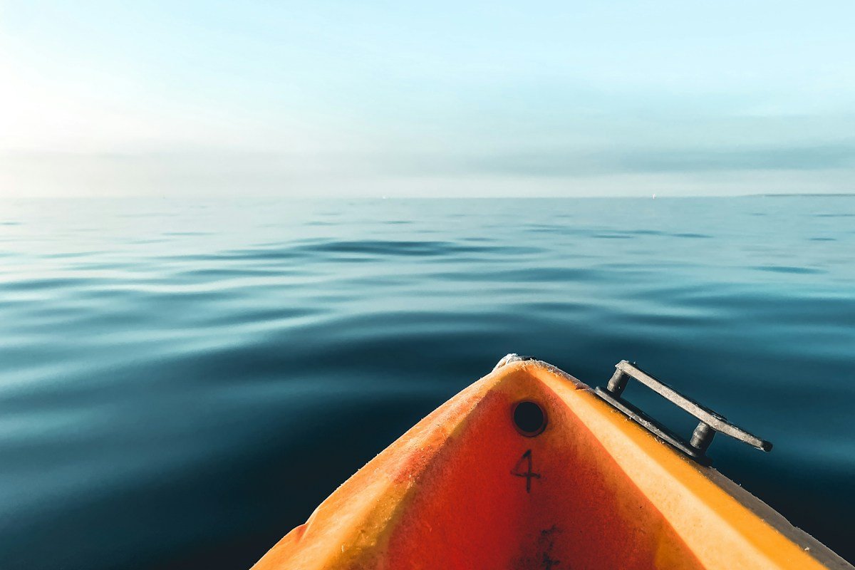

Ocean kayaking across exposed coastal environments represents one of the purest and most demanding forms of wilderness exploration. Navigating a low-volume, human-powered composite craft through open marine waters requires a sophisticated synthesis of physical oceanography, synoptic meteorology, nautical piloting, and cold-water survival physiology. Along rugged continental coastlines, island archipelagos, and remote fjords, sea kayakers confront powerful dynamic forces: multi-knot tidal streams surging through narrow constrictions, oceanic groundswells shoaling violently against shallow reefs, and gale-force coastal winds capable of generating steep, breaking seas within minutes. In this unforgiving marine arena, small operational errors or navigational miscalculations can rapidly escalate into life-threatening emergencies far beyond the reach of immediate rescue.
Unlike inland flatwater paddling, coastal sea kayaking operates entirely within a dynamic, moving medium. The marine water column shifts continuously in response to lunar and solar gravitational cycles, bathymetric contours, and atmospheric pressure systems. A passage that appears calm and benign at high-water slack can transform within two hours into a raging tidal race with massive standing waves, whirlpools, and violent overfalls as the ebb tide accelerates over submarine ridges. Successful expedition leaders must possess the technical knowledge required to calculate hourly tidal flows, plot vector compensation angles for wind leeway and current drift, and anticipate localized microclimatic wind shifts driven by coastal topography.
Furthermore, open-water coastal safety depends on an uncompromising commitment to self-sufficiency and redundant safety engineering. Paddlers must master advanced rough-water boat handling, instantaneous rolling maneuvers, multi-craft assisted rescue protocols, and long-line open-water towing systems. Equipment selection must be tailored to extreme marine environments: expedition sea kayaks engineered with high secondary stability and robust watertight bulkheads, breathable immersion drysuits that negate the rapid lethality of cold-water shock, and military-grade communication arrays including digital selective calling VHF radios and satellite tracking beacons.
Beyond mechanical skills and gear, coastal expedition success is grounded in sound nautical judgment and continuous situational awareness. Expedition leaders must balance physical fatigue, team dynamics, changing sea states, and exposure risks while adhering to strict weather cutoff thresholds. This comprehensive operational manual provides an authoritative, exhaustive blueprint for planning, navigating, and executing coastal ocean kayaking expeditions across challenging marine wilderness environments.
Marine Oceanographic Hydrodynamics: Tidal Streams, Slack Water, and Rule of Twelfths
Tides are long-period planetary waves generated by the gravitational attraction of the moon and sun acting upon Earth’s rotating oceans. In coastal waters, the vertical rise and fall of the tide drives horizontal water movements known as tidal streams or tidal currents. Understanding the physics of tidal streams is the primary foundation of coastal sea kayak navigation, as current velocities in channels, straits, and around headlands frequently exceed six to ten knots, vastly outstripping the maximum sustained hull cruising speed of an expedition paddler (typically three to four knots).
Tidal flow does not accelerate and decelerate at a linear rate throughout its approximate six-hour cycle between low water and high water. Instead, tidal flow follows a harmonic curve accurately approximated by the nautical Rule of Twelfths. During the first hour after slack water, the tide moves approximately one-twelfth of its total volume; during the second hour, two-twelfths; during the third and fourth hours (peak flow), three-twelfths each hour; during the fifth hour, two-twelfths; and during the final sixth hour, one-twelfth. Consequently, half of the total tidal water volume moves during the central two hours of the cycle, producing maximum current velocities and peak sea state turbulence.
Slack water, the brief window when horizontal water movement ceases as the tide transitions from flood to ebb or vice versa, represents the critical tactical window for sea kayakers negotiating hazardous headlands or crossing exposed straits. Slack water does not necessarily coincide with the times of local high or low tide; in complex coastal sounds and channels, the inertia of moving water masses causes tidal streams to continue running for up to an hour or more after high-water stand. Expedition navigators consult specialized tidal stream atlases and current tables to identify the precise moment and duration of true hydrodynamic slack.
When a powerful tidal stream encounters bathymetric constriction (such as a shallow underwater reef or a narrow passage between islands), the conservation of fluid mass dictates that water velocity must increase exponentially. This accelerated flow generates dramatic surface features: tidal races, overfalls, and powerful whirlpools. When a fast-flowing tidal stream runs in direct opposition to incoming oceanic swell or prevailing wind (wind-against-tide), the waves steepen dramatically, their wavelengths compress, and their faces become vertical and unstable, producing dangerous breaking seas capable of pitchpoling or swamping kayaks.
Coastal Bathymetry and Swell Refraction: Shoaling and Standing Wave Dynamics
Open-ocean swells are generated by distant offshore storm systems where intense winds blow across vast uninterrupted expanses of open water (the fetch). As these deep-water gravity waves propagate across open ocean basins, they organize into long-period swells characterized by wavelengths exceeding several hundred meters and wave periods ranging from ten to twenty seconds. In deep water where depth exceeds half the wavelength, these waves travel virtually unnoticed by surface vessels, their orbital energy decaying exponentially with depth.
However, as long-period swells approach coastal waters and encounter shoaling bathymetry where water depth drops below half the wavelength, the wave base touches the seabed. Friction with the bottom slows the wave propagation velocity, causing the wavelength to compress while wave height increases dramatically, a phenomenon known as shoaling. Energy conservation forces the wave to grow in amplitude until the water depth is approximately 1.3 times the wave height, at which point the wave becomes top-heavy and breaks violently onto the coast or offshore reefs.
Bathymetric contours also dictate wave refraction, the bending of wave crests as different segments of a wave front encounter shallow water at varying times. When swells approach a protruding coastal headland, the central portion of the wave slows first over the shallow submerged ridge extending seaward from the point, while the flanks of the wave continue moving at higher velocity through deeper water. This causes the wave front to bend and converge directly upon the headland, concentrating wave energy and creating massive, unpredictable breakers around the point.
Where steep rock cliffs plunge directly into deep water without an intervening shallow shelf, incoming waves do not break; instead, they reflect almost entirely off the vertical rock face. The incoming swell and the reflected wave superimpose, creating clapotis, or standing waves. Clapotis features chaotic, pyramidal water spikes that surge vertically without horizontal translation. Paddling through clapotis zones demands exceptional secondary stability, loose hips, and dynamic bracing strokes to prevent sudden capsizes in the turbulent rebound water.
Marine Weather Forecasting: Synoptic Meteorology, Barometric Trends, and Coastal Wind Regimes
Weather is the single greatest determinant of safety and operational success in ocean kayaking. A sea kayaker operates directly at the interface between the atmosphere and the ocean surface, where atmospheric pressure gradients generate winds that immediately dictate wave heights, chop frequency, and navigational drift. Expedition leaders must develop deep competency in interpreting surface synoptic charts, identifying frontal boundaries, tracking barometric tendencies, and predicting localized coastal microclimates.
A falling barometer is the primary early warning indicator of an approaching cyclonic low-pressure system and associated cold or warm fronts. A steady barometric decline exceeding one millibar per hour indicates moderate wind increases; a rapid fall exceeding two to three millibars per hour heralds the imminent arrival of severe gale-force or storm-force winds. As cold fronts pass over coastal waters, the wind frequently veers rapidly by ninety to one hundred and eighty degrees, shifting from a warm, moist pre-frontal southerly to a violent, gusty post-frontal northwesterly that instantly transforms the direction and character of coastal seas.
Coastal topography profoundly distorts regional synoptic winds, generating localized wind phenomena that are invisible on coarse synoptic forecast models. Cornering effects occur where prevailing winds bend around high mountainous headlands, accelerating to speeds twenty to forty percent higher than ambient offshore winds. Funneling or gap winds occur in narrow sounds and fjords, where coastal mountain ranges constrict air masses, creating high-velocity wind jets that blow down channels with intense force.
During settled summer weather, thermal diurnal wind regimes dominate coastal paddling. As the continental landmass heats rapidly under solar radiation, rising warm air creates a localized thermal low over the coast, drawing cool marine air inland to create an onshore sea breeze. Sea breezes typically develop by mid-morning, peak in the early afternoon with wind speeds of fifteen to twenty-five knots, and dissipate toward sunset. Conversely, nocturnal cooling of mountain snowfields produces katabatic winds, high-density cold air masses that plunge down coastal valleys and out to sea at night with violent, sudden gusts.
Sea Kayak Naval Architecture: Hull Geometry, Secondary Stability, and Tracking Dynamics
An expedition sea kayak is a masterpiece of specialized naval architecture designed to navigate rough seas while carrying substantial payload weights. Hull dimensions typically range from 5.0 to 5.5 meters (16.5 to 18 feet) in overall length, with beams measuring 52 to 56 centimeters (20.5 to 22 inches). Understanding the hydrodynamic trade-offs inherent in hull geometry allows paddlers to match boat designs to specific expedition environments.
Composite construction methodologies dictate hull stiffness, durability, and open-water acceleration. High-end expedition kayaks utilize vacuum-bagged epoxy laminates incorporating woven fiberglass, Kevlar aramid fibers, and high-modulus carbon fiber fabrics. Carbon-Kevlar layups yield extraordinary tensile strength and impact resistance, enabling the hull to flex microscopically under heavy wave impact without delaminating or puncturing against sharp barnacle-encrusted granite reefs. The interior of the kayak is compartmentalized by watertight foam or composite bulkheads that isolate front and rear gear hatches, creating redundant buoyant chambers capable of floating the craft even if the central cockpit fills completely with seawater.
Hull stability is divided into initial (primary) stability and secondary stability. Initial stability refers to the kayak’s resistance to tipping when resting flat in calm water; hulls with wide, flat bottoms exhibit high initial stability, making them feel secure to novices. However, in rough seas, a high-initial-stability hull follows the slope of passing waves, causing violent pitching and rolling. Expedition sea kayaks feature shallow-V or rounded hull cross-sections that provide lower initial stability but immense secondary stability. When edged onto its side in rough water or heavy cross-seas, the flared hull buoyant volume engages the water, locking the boat into an exceptionally stable, balanced posture.
Rocker, the longitudinal upward curvature of the hull from the center toward the bow and stern, directly influences maneuverability and tracking. A boat with minimal rocker possesses a long waterline length that tracks in a straight line with high forward speed, but turns sluggishly in tight sea caves and breaking surf. A heavily rockered hull spins effortlessly on wave crests and carves dynamic turns when edged, but requires constant course corrections in crosswinds.
Tracking control in crosswinds is managed through skegs or rudders. When paddling across a strong wind, the kayak naturally weathercocks, turning its bow into the wind due to hydrodynamic drag concentrated around the bow while the stern slides downwind. A retractable skeg (a drop-down foil located in a watertight stern skeg box) allows the paddler to trim the boat’s hydrodynamic center of lateral resistance. Deploying the skeg partially or fully locks the stern in place, neutralizing weathercocking and allowing the paddler to maintain a straight compass heading without tiring corrective sweep strokes.
Open-Water Navigation: Dead Reckoning, Ferry Glides, and Magnetic Vector Compensation
Navigating an ocean kayak across an open-water crossing without visual terrestrial landmarks requires rigorous maritime dead reckoning and vector mathematics. Unlike surface hikers who navigate relative to fixed terrain contours, a sea kayaker operates in a multi-vector environment where the vessel is simultaneously propelled forward by the paddler, pushed sideways by wind leeway, and transported across the seabed by tidal streams.
Plotting an open-water crossing begins with calculating a course to steer (CTS) using a navigation vector triangle. The paddler determines the ground track (the desired true compass course from departure point to destination) and the nautical distance. Next, the navigator identifies the tidal stream vector (the direction and hourly velocity of the current expected during the crossing) from tidal stream atlases. Finally, by plotting the boat speed vector (typically three knots) against the current vector, the navigator calculates the magnetic compass heading required to counteract current displacement, ensuring the kayak travels along the intended seabed track.
Wind leeway compensation must be factored into the equation. Crosswinds push the high-profile deck, deck bags, and paddler’s torso downwind, introducing a leeway drift angle typically ranging from five to fifteen degrees depending on wind velocity and deck load. The paddler adjusts their magnetic compass course into the wind to cancel leeway drift.
When crossing an active tidal channel, paddlers employ a ferry glide technique, angling the kayak’s bow into the current at a calculated angle while maintaining forward momentum. By aligning a distant land feature behind a closer foreground marker (a transit or range), the paddler visually confirms whether they are holding their ground track. If the foreground marker appears to drift to the right relative to the background feature, the kayak is slipping down-current, requiring an immediate course correction into the flow.
Thermal Exposure Management: Cold Water Shock Kinetics and Immersion Protection
Cold water is the primary physical hazard in ocean kayaking, transforming a simple capsize into a fatal crisis within minutes if paddlers are inadequately protected. Most oceanic coastal waters outside tropical zones maintain temperatures between four and fifteen degrees Celsius (thirty-nine to fifty-nine degrees Fahrenheit). Immersion in water beneath fifteen degrees Celsius triggers a rapid, predictable physiological sequence known as the 1-10-1 cold water survival framework.
The first phase, Cold Water Shock, occurs within the first sixty seconds of sudden immersion. Cold thermal receptors in the skin trigger a massive, involuntary gasp reflex, followed by uncontrollable hyperventilation, acute peripheral vasoconstriction, and a violent spike in blood pressure and heart rate. If a paddler’s face is submerged during the initial gasp reflex, they aspirate water directly into the lungs, leading to immediate drowning. If the paddler survives the first minute, the hyperventilation subsides, allowing cognitive control to return.
The second phase, Cold Incapacitation or Swim Failure, develops within ten minutes of immersion. Rapid conductive cooling of peripheral muscle tissue in the arms and legs impairs neuromuscular transmission. Fine motor skills vanish first: fingers become stiff claws unable to grip paddle shafts, unbuckle rescue gear, or operate radio controls. As cooling reaches deep forearm and calf muscle groups, the paddler loses the ability to execute swimming strokes or climb back into their kayak, resulting in drowning even in calm seas if a personal flotation device (PFD) is not worn.
The third phase, Clinical Hypothermia, typically requires thirty to sixty minutes to drop core body temperature below thirty-five degrees Celsius. Immersion protection is therefore non-negotiable on all coastal expeditions. Paddlers must dress strictly for the water temperature rather than the ambient air temperature. A high-performance, breathable membrane drysuit (constructed with waterproof latex or neoprene neck and wrist gaskets, integrated fabric socks, and heavy Cordura reinforcement) worn over moisture-wicking synthetic or merino wool fleece layers is the gold-standard thermal shield, maintaining dry, warm microclimates and extending operational survival horizons from minutes to hours.
Self-Rescue and Assisted Rescue Mechanics in Rough Seas
In coastal sea kayaking, an accidental capsize in rough water is not considered an extraordinary disaster; it is a routine operational contingency that must be managed with instantaneous, automated technical recovery. All expedition paddlers must possess reliable, bombproof self-rescue and assisted rescue capabilities executable in breaking seas, strong winds, and high swell.
The first line of defense is the sea kayak roll. A paddler who capsizes sets their paddle blade against the water surface, flexes their torso, and executes a synchronized hip snap, rotating the kayak upright beneath their torso before rolling their head out of the water. Mastery of rough-water combat rolls (such as the screw roll, Pawlata roll, or Greenland storm roll) allows a paddler to recover upright within three seconds without ever exiting the cockpit or taking water into the hull.
If a wet exit occurs, assisted rescues provide the fastest, most reliable method for re-entering the kayak. In an assisted T-rescue (or X-rescue), the rescuer maneuvers their kayak perpendicular to the capsized boat. The rescuer pulls the overturned kayak across their spraydeck, rolling it inverted to break cockpit suction and draining all water from the cockpit within ten seconds. The rescued boat is flipped upright and slid back into the water alongside the rescuer’s hull, gunwale to gunwale. The rescuer firmly grips the victim’s cockpit coaming to provide absolute stability while the swimmer scrambles over the rear deck, slides their legs into the cockpit, and reseats themselves before reattaching their spraydeck.
For solo self-rescues, the paddle float rescue is the primary standard. The swimmer inflates a dual-chamber nylon paddle float, slides it securely over one paddle blade, and rigs the paddle shaft perpendicular to the kayak as an outrigger buoy. The buoyant outrigger prevents the kayak from tipping while the paddler kicks their legs to the surface, vaults their torso onto the back deck, slips their legs into the cockpit, and uses a high-capacity manual bilge pump to evacuate residual water.
Coastal Surf Zone Management: Launching and Landing in Heavy Shorebreak
The surf zone represents the high-risk transition boundary where open-water sea kayakers must interact with the terrestrial coastline. Launching and landing through breaking ocean surf requires precise timing, physical agility, and an intuitive grasp of breaking wave hydrodynamics, as pitching shorebreak waves possess the kinetic energy to smash composite hulls, dislocate shoulders, and pin paddlers beneath overturned boats.
When launching into surf, the paddler studies the wave sets from the beach, counting the wave period and identifying the lull between larger sets. The paddler seals their spraydeck, positions the kayak perpendicular to the oncoming waves in ankle-deep water, and accelerates aggressively into the break during a lull. When punching through an oncoming breaking wave crest, the paddler maintains forward momentum, leans forward aggressively over the front deck, and plants a deep forward stroke directly into the face of the wave. Leaning backward during wave impact causes the bow to launch vertically into the air, resulting in an end-over-end pitchpole capsize.
Landing through surf is even more technically challenging. The paddler waits beyond the surf zone, observing set intervals and identifying an incoming lull. As a small wave passes beneath the hull, the paddler follows closely behind on the back of the wave, paddling hard to stay in the trough between wave crests. If a breaking wave catches the kayak from behind, the hull will accelerate onto the wave face and broach, turning sideways into the wave trough.
When a broach occurs in breaking surf, the paddler must immediately execute a low brace or high brace directly into the breaking wave face, leaning their torso toward the wave while allowing the bottom of the hull to present to the shore. Leaning away from the wave catches the shoreward gunwale in the water, causing an instant violent capsize. Riding a broached kayak sideways into the beach on a solid brace (sidesurfing) allows the paddler to maintain control until the boat grounds in shallow water, permitting a rapid exit onto the beach.
Long-Distance Expedition Ergonomics: Forward Stroke Biomechanics and Overuse Injury Prevention
Sustaining multi-week coastal expeditions requires flawless stroke biomechanics to prevent debilitating overuse injuries. An expedition sea kayaker executes between 10,000 and 15,000 paddle strokes per day, pushing against water resistance under loaded boat conditions. Relying on isolated arm and shoulder muscles leads rapidly to bicep tendonitis, rotator cuff impingement, and acute carpal tunnel syndrome within the first three days of paddling.
Efficient forward stroke propulsion relies entirely on torso rotation and large core muscle groups, including the latissimus dorsi, abdominals, and obliques. The paddler anchors their feet firmly against the footpegs, initiating each stroke by planting the paddle blade near the toes. Rather than pulling the paddle backward with the arms, the paddler uncoils their torso, using core rotation to lever the kayak past the anchored blade while pushing forward with the foot on the active paddle side. The arms remain relatively straight, functioning as non-fatiguing mechanical linkages between the paddle shaft and the rotating core.
Paddle blade selection directly impacts joint ergonomics. European teardrop blades provide immense instantaneous bite and power for rough-water maneuvering, but exert heavy peak torque on wrist and shoulder joints. Traditional narrow Greenland skin-on-frame wooden paddles, characterized by narrow unfeathered symmetrical blades with loom shoulders, slice smoothly into the water with minimal cavitation, reducing joint strain and permitting effortless cadence over forty-kilometer paddling days. Paddlers utilizing feathered paddles must ensure feather angles remain beneath thirty to forty-five degrees to eliminate excessive wrist extension during the return stroke.
Marine Communications, EPIRB Tracking, and Search-and-Rescue Coordination
Operating in remote coastal waters demands multi-layered, redundant marine telecommunication arrays. A sea kayak’s low physical profile makes it virtually invisible to large commercial ships and coast guard radar systems, particularly in heavy swell and foggy conditions. Expedition paddlers must possess dedicated electronic signaling tools capable of transmitting distress alerts across international maritime frequencies.
The primary tactical tool is a submersible IPX8-rated handheld VHF marine radio equipped with Digital Selective Calling (DSC) and integrated GPS. In an emergency, pressing the protected red DSC distress button transmits an automated digital Mayday broadcast containing the vessel’s precise GPS coordinates and Maritime Mobile Service Identity (MMSI) number across Marine Channel 70, alerting all coast guard stations and commercial vessels within a ten-to-fifteen-mile radius without requiring verbal voice transmission.
Beyond VHF range, satellite technology bridges the communication gap. Expedition teams carry dual-frequency 406 MHz Personal Locator Beacons (PLBs) registered with national search and rescue databases, alongside two-way satellite communicators (such as Garmin inReach units operating on the global Iridium satellite network). Triggering a 406 MHz beacon routes distress telemetry directly through the international Cospas-Sarsat satellite constellation to rescue coordination centers, initiating air and sea extraction protocols within minutes. Handheld marine flares, high-intensity signal mirrors, and radar reflectors mounted on deck further enhance visual locating during night or rough-sea search operations.
Expedition Camp Logistics: Tidal Zone Camping and Marine Conservation
Establishing an expedition camp along exposed marine coastlines requires constant vigilance regarding tidal ranges. Along macro-tidal coastlines (such as the Pacific Northwest, Maine, or the British Isles), vertical tidal ranges exceed four to eight meters, driving horizontal water lines hundreds of meters across gently sloping beaches between low and high tide.
Paddlers must identify the astronomical spring high-tide line, marked on beaches by the highest wrack line of dry seaweed, driftwood, and marine debris. Tents and base camps must be pitched well above this debris line, particularly if an approaching storm system is forecast to bring barometric pressure drops and storm surges that can push sea levels a meter above predicted astronomical tide tables. Fully loaded expedition kayaks must be hauled completely above the high-tide line and securely tied off to heavy driftwood logs or bedrock anchors using marine painter lines.
Potable water sourcing is a critical logistical challenge. Coastal wilderness areas often lack clean freshwater streams, and coastal beach seeps are frequently brackish or contaminated with marine salt spray. Expedition teams carry gravity water filtration systems and chemical purification tablets, mapping guaranteed freshwater estuaries along the route. Paddlers allocate three to four liters of water per person per day for drinking, rehydration of freeze-dried meals, and personal hygiene.
Marine wilderness ethics dictate strict adherence to Leave No Trace principles. Intertidal zones are fragile biological communities inhabited by delicate invertebrates, anemones, and marine flora; paddlers launch and land on sand or gravel beaches rather than dragging heavy hulls across sensitive rocky kelp reefs. All solid human waste in coastal zones must be managed according to local marine regulations: either packed out in sealed waste canisters or buried in intertidal sand beneath the low-tide line where marine bacteria and twice-daily tidal cycles rapidly decompose waste.
To establish rigorous institutional standards for ocean kayaking safety across varying coastal environments, expedition leaders and marine search coordinators rely on comprehensive diagnostic matrices. These nautical frameworks allow paddlers to evaluate sea state parameters, hydrodynamics, boat design requirements, and rescue complexity across open ocean, tidal rapids, surf zones, and glaciated fjord environments.
The following diagnostic matrix provides a comparative nautical reference evaluating primary marine operational environments, dominant oceanographic hazards, required naval architecture, navigation demands, and emergency extraction protocols.
Comparative Diagnostic Matrix of Coastal Sea Kayaking Environments
| Marine Environment | Dominant Hydrodynamic Hazards | Required Hull & Deck Configuration | Navigational & Weather Demands | Emergency Extraction Complexity |
|---|---|---|---|---|
| Exposed Ocean Headlands | Swell refraction, clapotis rebound waves, wind-against-tide steep seas, cornering winds | High secondary stability, moderate rocker, retractable skeg, reinforced glass or carbon hull | Hourly tidal stream calculations, precise slack-water timing, synoptic front tracking | High; sheer cliffs prevent shoreline landing; requires offshore roll, tow, or coast guard rescue |
| Tidal Races & Overfalls | 6-10 knot horizontal currents, standing waves, whirlpools, boil lines, violent eddy lines | Maneuverable rockered hull, tight keyhole cockpit, neoprene spraydeck with implosion bar | Rule of Twelfths current modeling, transit alignment, ferry gliding vector angles | Extreme; turbulent boils prevent standard paddle float rescues; requires combat rolling |
| Ocean Surf Zones | Plunging breakers, shorebreak dumpers, broaching, pitchpoling, structural hull breakage | Durable polyethylene or heavy composite, low rear deck, thigh braces, helmet, PFD | Wave period timing, identifying set intervals, reading bathymetric sandbar rips | Moderate to high; close to shore, but breaking waves cause equipment loss and spinal impacts |
| Glaciated Fjords | Catastrophic glacier calving tsunamis, brash ice fields, violent katabatic squalls | Extended expedition volume, heavy gelcoat, skeg, full immersion drysuit, ice paddle blades | Katabatic wind awareness, safe standoff distance from glacier faces (3x cliff height) | Maximum; sub-two-degree water; zero road access; multi-day satellite beacon extraction |
| Open Island Crossings | Total loss of visual landmarks, leeway wind drift, sudden squalls, commercial vessel traffic | Fast tracking hull, low windage, deck-mounted compass, radar reflector, AIS transponder | Dead reckoning, vector triangle math, GPS backup, VHF marine channel 16 monitoring | High; distance from shore makes self-rescue or buddy rescue the only immediate survival option |
Mastering these complex coastal environments enables expedition sea kayakers to navigate planetary waterways with profound confidence and safety. For comprehensive standards regarding coastal navigation, marine weather charts, and ocean safety, paddlers consult authoritative organizations including the National Oceanic and Atmospheric Administration Ocean Service and the Paddle UK Coastal Leadership Association. In-depth seamanship and wilderness rescue standards are cataloged by the American Canoe Association Coastal Kayak Committee, while life-saving maritime safety updates can be reviewed through the Royal National Lifeboat Institution Marine Safety Portal and the International Maritime Organization Search and Rescue Section.
Frequently Asked Questions About Ocean Kayaking Expeditions
What is the Rule of Twelfths in coastal sea kayak navigation?
The Rule of Twelfths is a mathematical framework that models the non-linear speed of tidal streams. It divides a six-hour tidal cycle into fractions: one-twelfth of tidal volume moves in the first hour, two-twelfths in the second, three-twelfths in the third and fourth hours, two-twelfths in the fifth, and one-twelfth in the sixth hour, demonstrating that peak currents occur mid-cycle.
How does a sea kayaker prevent weathercocking in crosswinds?
Weathercocking occurs when crosswinds blow the stern of the kayak downwind, causing the bow to turn into the wind. Sea kayakers deploy a retractable skeg or adjust a stern rudder to increase the hydrodynamic lateral resistance at the stern. Trimming the skeg balances the wind forces, allowing the kayak to maintain a straight compass heading.
What triggers the rapid onset of swim failure during cold-water immersion?
Swim failure, or cold incapacitation, occurs within ten minutes of cold-water immersion as rapid conductive heat loss cools peripheral nerves and muscle tissue in the arms and legs. Neuromuscular signaling slows, preventing finger motor control and coordinated swimming strokes, leading to drowning unless a life jacket keeps the head afloat.
What is clapotis and how should paddlers negotiate it?
Clapotis is a non-breaking standing wave phenomenon created when incoming ocean swells reflect off vertical rock cliffs and superimpose upon approaching waves. The resulting water forms chaotic, pyramidal spikes. Paddlers navigate clapotis by maintaining forward momentum, relaxing their hips, and employing dynamic low braces to absorb vertical surges.
What is the primary operational advantage of an assisted T-rescue?
The assisted T-rescue allows an upright rescuer to pull an overturned kayak across their own spraydeck, completely emptying all water from the capsized cockpit within ten to fifteen seconds. The rescuer then stabilizes the empty kayak gunwale-to-gunwale, allowing the swimmer to scramble securely back aboard without needing to pump water.
How do long-period swells behave differently from local wind waves?
Long-period swells are generated by distant ocean storms, possessing wavelengths of hundreds of meters and periods of ten to twenty seconds. Because their wave energy extends deep underwater, they shoal violently and refract significantly around headlands. Local wind waves have short periods, steep chop, and break with much less shoaling energy.
What distance should sea kayakers maintain from tidewater glacier faces?
Sea kayakers must maintain a minimum standoff distance equal to three to four times the height of the glacier face, or at least one-half nautical mile. Tidewater glacier calving events drop thousands of tons of ice into fjords, creating immediate displacement tsunamis capable of swamping kayaks or throwing boats against rocky shorelines.
What role does secondary stability play in rough-water sea kayaking?
Secondary stability is the resistance of a kayak to capsizing when tilted on its edge. While rounded or shallow-V hulls feel slightly tippy in flat water (low initial stability), their flared side profiles provide immense buoyancy when tilted, allowing experienced paddlers to carve turns and absorb breaking waves without flipping.
How does a ferry glide allow paddlers to cross fast tidal channels?
A ferry glide involves angling the kayak’s bow into an oncoming current at a precise vector angle while maintaining forward paddling momentum. The lateral component of the current pushes the boat across the channel while the forward speed prevents the kayak from being swept downstream, maintaining a straight ground track.
Ocean Kayaking Expedition Synthesis and Marine Stewardship
Coastal sea kayaking provides an intimate and profound connection to the world’s oceans. By piloting a human-powered craft across complex marine wilderness, paddlers directly engage with the fundamental physical laws governing planetary tides, wave mechanics, and atmospheric energy transfers. When executed with rigorous nautical discipline, cold-water safety protocols, refined boat-handling mastery, and deep environmental respect, ocean kayaking transforms wild coastlines into extraordinary pathways of exploration, scientific wonder, and enduring maritime adventure.